Tested: TomTom Rider 500 & 550 sat-nav review


By John Milbank
Consumer Editor of Bennetts BikeSocial
11.10.2018


Date reviewed: September 2018 | Tested by: John Milbank | Price: £399.99 | www.tranam.co.uk
While there are good arguments for using a smartphone as a GPS on your bike (or a cheaper car sat-nav or even a traditional paper map), those who do a lot of miles and need reliable, consistent and convenient navigation will appreciate the glove friendly, waterproof and rugged build of a dedicated motorcycle sat-nav.
I’ve been using the TomTom Rider devices since the first 400 was launched in 2015 (as well as the older Rider before that), and this new 550 for the past six months, both on the bike and in the car…
Features and mapping included (TomTom Rider 550)
• Worldwide maps with free updates for as long as TomTom supports the device
• Free updates of speed cameras
• Update via WiFi – no connection to computer needed
• Live traffic and dynamic redirection
• Timeline showing upcoming fuel, delays etc
• Curated ‘TomTom road trips’ routes
• Motorcycle points of interest included
• Double the processing speed of the 400 range
• Water resistant and drop-proof
• Connects to your smartphone for texts, calls and Siri / Google Now
• Text messages can be read out
• Clean and easy to understand display
• Landscape or portrait views
The Rider 550 costs £399.99, but the 500 is also available at £379.99 – this doesn’t include the motorcycle points of interest, or more crucially the worldwide mapping. If you later decide you want additional mapping outside of Europe, you’ll need to buy it separately, and it won’t include free updates. For £20 more, I’d suggest the 550 is worth the extra investment – even if you don’t ever intend to take your bike out of Europe, you may well want to use the device in a hire car.
A premium pack is also available, which includes the useful powered car mounting kit, as well as the locking bike mount, which means you can safely leave your device fitted while paying for fuel or popping into the services for the loo.


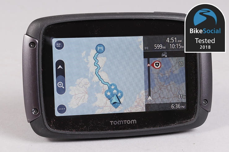
The TomTom simply slips into its mount – here it’s shown with the optional locking bracket, which bolts to the rear
Mounting to the bike
The TomTom Rider 500 and 550 both come with a bike mount and Ram brackets to clamp to the bars or fit to a mirror clamp. The cable has a small connector near the mount, and terminates in a pair of exposed wires. It’s a shame that ring connectors aren’t supplied to fit to your battery, but the cable is slim and easy to route through your bike. There’s no fuse fitted, but the circuit inside the mount has a self-resetting fuse.
Of course, if you have the bracket wired directly to the battery, rather than picking up from an ignition switched supply, leaving the TomTom in place will slowly drain your bike’s battery. You should also be aware that, even when the device is removed, the mount still pulls about 5mA from the battery. This will have a negligible effect on your bike’s battery, but if left for a long time it could have an impact.
The mount allows you to spin the TomTom through 90°, where it will change orientation – just like a smartphone. I’ve never found this useful, and always prefer the landscape format. The problem is that, when riding at speed, the display can sometimes get confused, spinning through 90° or even going upside own. On the older devices, it could be very slow to recover, but the new quad-core processor is a lot better. Having said that, I’ve had the new 550 show the screen upside down for a good few minutes. Fortunately, you can easily lock the orientation in the menu, then you won’t have any more problems.
Set-up and updating
The TomTom works out of the box, but it’ll likely need an update. The previous models had excellent software for PCs and Macs but the 500 and 550, with WiFi updates, are a doddle. When taking it out of its cradle – so disconnecting it from power – it’ll let you know if any updates are available.
Big updates, like new maps, should be done when attached to a power outlet, but all you have to do is pop it back on the bike, or connect to a USB power supply using the supplied micro-USB cable.
The menu pages can be tweaked to suit you – just click and hold on an item to move it between pages. I like to have ‘search’, ‘current route’ and ‘petrol station’ on the first menu page.
Other elements of the TomTom’s appearance can be tweaked, like colour and the width of the route bar on the left (have it wide for more detailed information), as well as options like auto zoom to a junction and what Points of Interest (POIs) are displayed.


The charging port and Micro SD card slot are hidden behind rubber covers
Touchscreen sensitivity
The TomTom’s screen is capacitive – like a smartphone – but cleverly it will work regardless of what type of gloves you’re wearing. You can adjust the sensitivity, but I usually have it set to ‘thin gloves’. The only disadvantage I’ve found to this is that when programming a route with bare hands, the device can be a little over-sensitive.
While some of the buttons can be a bit small, I generally find the device fine to use on the move – you do need to rest your hand against it while touching buttons to avoid accidentally scrolling a menu item rather than selecting it, but it’s the same on other brands, and a technique you get used to.
The problem with a capacitive screen is that water can trigger it, something you won’t find with a traditional screen, like that fitted to the Garmin 396; you’ll find forums bemoaning this issue, saying that the TomTom is useless, but having ridden in all weathers using every model of the Rider, I can only say that it hasn’t been a real issue for me.
I’ve only had two instances of the TomTom map moving around due to the rain, though if I fire a hose at it, it will (unsurprisingly) trigger more readily. Ultimately, it’ll depend on where the GPS is fitted to your bike – behind a screen it’s less likely to get really heavily hit, and even making sure it’s mounted as upright as possible will greatly reduce the chances of rain triggering it. It does take a lot of rain to affect the screen, and when you’re riding, that rain is usually blown clear, whether it’s on a naked Suzuki GSX-S750 or a KTM 1050 Adventure.
If you are having problems, the Wunderlich sun shade from Nippy Normans costs £30 and provides a peak that helps keep the rain away. There are cheaper versions available on eBay, but they attach using rubber bands across the back; the high-quality Wunderlich version simply clips on and looks like part of the TomTom.

The value of the TomTom Rider’s sidebar really can’t be underestimated
Display layout & clarity
Thanks to having a capacitive screen, rather than a separate touch layer as on the older TomToms and other devices, the display is very clear with high contrast. With bright sun behind it can still be washed out with glare, but in most circumstances it’s very good. Again, the Wunderlich sun shade can help here, but it’s not an essential.
TomTom completely redesigned the user interface for the Rider 400 range, and the style is continued in the 500 and 550. Initially criticised by some for being too basic looking, it’s actually a piece of design genius, and proof that sometimes it really is best to start fresh.
All the information you need for a ride is displayed on screen, such as arrival time, distance, next turn, current speed, speed limit, time etc. The real deal-breaker through is the side bar, which shows important info over roughly the next 40 miles of your journey – this includes traffic problems and points of interest, but most usefully for bikers, it always shows how far away the next two filling stations are. This is brilliant, as if you see a filling station coming up, but know there’s another 10miles away, you may well decide to keep riding – only motorcyclists will understand the true value of this feature.

Waterproofing
Search for TomTom Rider waterproof problems and you’ll find issues with moisture building up inside the screen. Forums can significantly amplify things, but I did have one of the very first Rider 400s that suffered this. TomTom openly admits that there was a problem with seals on the first batch in 2015, but having used the replacement that was supplied to anyone suffering this fault, as well as the 410, 450 and now the 550 on most rides since then, I can confidently say that it was a very isolated problem that’s been solved.
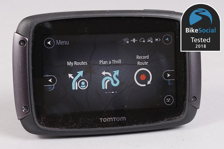
Ease of route planning
If you’re programming a route while the TomTom can’t ‘see’ any satellites, the device will simply plan from the last known location, which is usually where your vehicle is anyway. If it’s not correct, the route will recalculate as soon as the GPS picks up a signal again. This is particularly useful if parked in an underground carpark, as you’re far more likely to take the correct turn as you leave the gate.
While the TomTom’s interface looks simple, there’s no shortage of options for route planning – whether fastest routes or the complex winding ‘thrill’ routes that can be tweaked for three levels of twistiness and three levels of elevation (for mountainous areas) – everything can be modified, and extra stops can be added.
While you can do everything on the TomTom itself, you can also plan routes and thrills on an iOS/Android app, or through the MyDrive website – once logged in, this very intuitive system keeps all of your routes and places in one location, as well as providing access to the curated ‘road trips’ offered by TomTom and other users. A route planned on here will seamlessly sync to your device, as long as it’s connected to the internet.

In back-to-back testing, TomTom gave the most accurate information on road closures
The TomTom is as accurate as any sat-nav I’ve used (they all lag a little on small roundabouts), and the simple display makes following the directions very easy, with or without the voice prompts, which can be turned on or off from the quick-menu that’s quickly accessible from the map screen.
The new, faster processor claims double the power and five times faster startup. Compared to the previous Rider 450, the 550 is twice as fast to start – 35 seconds, versus 1 min 8 seconds. Overall, it does feel snappier to navigate, and route planning is more immediate; the average time to plan a fastest from the centre of the UK to its extremities is 7.6 seconds on the 550, whereas the same routes on the 450 take an average of 18.8 seconds.
It’s in the more complex planning that the new processing power makes a more significant difference – using ‘plan a thrill’ to find a twisty back-road route from Peterborough to Bournemouth takes 12 seconds on the 550 and 30 seconds on the 450. These thrilling routes are intensive on the device when you go off-course – while it depends where you are in relation to the originally planned route, any calculation time can be very significant while you’re riding. The 550 is typically more than twice as fast at recalculating a ‘thrill’ route, which can make all the difference when in a busy area; the older 450 can decide on an upcoming turn, but by the time it’s worked the full route out, you’ve passed that turn so it starts again, resulting in it sometimes being up to four times slower than the new model.
On standard route planning, where the TomTom is simply finding you the fastest route to your destination, the performance gains are minimal; in fact, on a couple of occasions the 450 was actually slightly faster, but only by fractions of a second.
Compared to the Garmin 396, the TomTom 550 is typically twice as fast to recalculate a fastest route, though the Garmin is often quicker to find a way back to an ‘adventurous’ route than the TomTom. However, a serious flaw in Garmin’s ‘adventurous’ routing is that if you stray too far from its directions it will simply stop navigation altogether, leaving you to reprogramme it. Given the improved speed of the new TomTom, it’s definitely the better system for those who want to explore.
I’ve yet to have the TomTom fail to notify me of a closed road (when live traffic data is enabled), something the Garmin 396 struggled with on a back-to-back test, and while you will always find a road somewhere that hasn’t yet made it to the latest map, free regular updates mean this is definitely unusual.
Finding fuel
Garmin’s dynamic fuel stops are useful if you’re in the wilds of Africa, travelling away from fuel for a long distance, but I’ve never found it better than TomTom’s side bar in the UK, France or Spain. Garmin’s system will gauge the distance to the next stop, and ask if you want to schedule a fill, but this does rely on your estimation of range: fine if you always ride at the same speed but I’ve seen 71mpg when riding to Dorset, and 58mpg when riding back.
Both the TomTom and the Garmin software allow you to see nearby fuel stops as a list or on a map, but since using the TomTom sidebar system – which always shows you the distance to the next two stops – I’ve never had to pull up and search for fuel.
Interestingly, during one back-to-back 200mile test ride of the two manufacturer’s sat-navs, the Garmin twice identified locations as fuel stops when they clearly hadn’t been for several years; the TomTom seems to have a far more up-to-date database to draw from and hasn’t yet let me down.
Speed camera notifications
Speed cameras are very clearly shown both on the map and in the sidebar, with the bar changing to yellow if you’re just over the limit, and red if you’re speeding more seriously. Very usefully, when you enter an average speed camera zone, the TomTom will display your average speed from the passing the first camera to the last.
Adapting your route / detours
Additional stops on your route can easily be added by touching on the map or searching for a location, and any traffic problems ahead for the next 35-40 miles are clearly displayed in the sidebar; clicking on them will show them on the map. If a faster route is available, it’ll be suggested on the sidebar with the predicted time saving. You can opt to have the TomTom automatically recalculate the route, but I prefer to make my own mind up if I think I can filter faster on the bike.
Alternative routes are also shown on the mapping as a green track off the blue one you’re following – it’s another way that the TomTom doesn’t force you to have to interact with it and touch buttons; only a very large detour early in your journey might rarely ask you to press one button to confirm you want to change your route.
Did you know? TomTom uses data from various sources for its live traffic, including the Highways agency, Apple, and of course its own systems, which also draw from the more than 95million devices in use in private and commercial vehicles around the world. As a supplier to many car manufacturers, traffic data is also drawn from here, giving incredibly accurate information.
Knowing of heavy traffic or road closures can be just as important on a motorcycle – you might for instance be able to filter through motorway holdups, but if an accident has shut the road, you’ll just end up at the front of the queue.
Additional features
TomTom’s ‘plan a thrill’ feature is one of the main additions, allowing you to set up a route to a destination that’ll take in twisty and/or hilly roads. It doesn’t know the best biking routes, and will sometimes go through a city if it’s twistier than the only other route, but it’s generally excellent. Of course nothing beats local knowledge, but I’ve found some really great roads in the UK and France using this feature.
Programming on the TomTom itself, you can touch a point on the map to select a circular thrilling route, or set a destination for a one-way trip. Here, the smartphone app is well worth using, allowing you to more easily set a twisty circular route that takes in the destination of your choice. You can also add other stops once it’s programmed. As long as your TomTom is connected to your phone, the route is sent instantly to the device.
Garmin’s ‘Adventurous routing’ gives very similar results, but you can more easily plan a circular trip based simply on the time you have. Ultimately, they both give some good rides, but they are more suitable for adventure bikes – sportsbike riders will likely complain of the tighter, often bumpier nature of the minor roads selected.
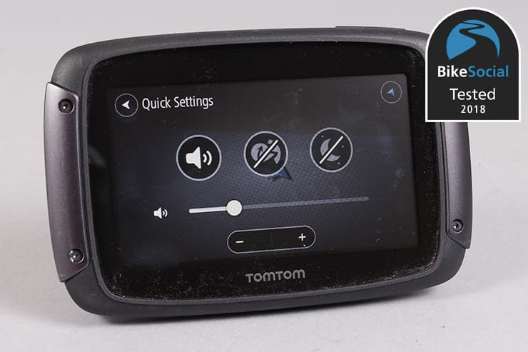
As long as you have the MyDrive app running on your phone, text messages and calls can also be displayed in a notification that pops up at the bottom of the screen, the rest of the display compressing to accommodate it – if you touch it, the message will be read out loud either through the built-in speaker, or your Bluetooth intercom. If you ignore it for a minute or so, it’ll disappear automatically, and if you don’t want to see them at all, you can very easily turn them off through the ‘quick settings’ menu. Once they’ve gone, there’s no option to go back through previous notifications, though I’d suggest if you want to do that, it’s best done when not riding or driving, in which case you might as well use your phone.
Unfortunately, as the time of writing the text and call notifications weren’t working between the 550 and an iPhone running iOS 11.4.1, though it’s worked fine in the past.
It’s a shame there’s no option to control music on your smartphone to play through your Bluetooth intercom, or even to take advantage of the MicroSD card slot and offer a media player like the Garmin… perhaps a future update will add this feature.
GPX route files can be imported via the MyDrive web portal, so you can use other programmes on your computer to plan routes if you wish.
Battery life
While a powered cradle is supplied, the TomTom has an excellent battery – I got from the office in Peterborough to Oulton Park and back without ever plugging it in (I had it tucked in a tank bag on an MV Agusta F3 800). Including riding the night before, finding the hotel, finding the track and riding home, this was well over six hours. The battery cut out when I was about 20miles from home (of course, I knew exactly where I was by then).
If you’re popping out on a bike with the TomTom tucked in a tank bag, you’ll be fine, and you can always charge it from USB.
This excellent battery life is also very useful when sitting in the house planning routes – something I’ve found a problem at times with some other brands.

Live traffic is very useful in a car, but also on the bike
Car use
In the car, you’ll ideally need to invest in the specific mount, but it’s worth it – on a recent drive home, which should take an hour and a half, the TomTom offered an alternative route that would save me 1hr 46mins. An accident on the M11 was causing severe delays, so the TomTom saved me a lot of time and hassle.
Parking can be found quickly using the dedicated menu option, and while it’s less of an issue than on a bike, the sidebar showing upcoming fuel and other POIs like traffic problems is a real benefit.
Verdict
TomTom’s operating system feels slick and intuitive compared to its competitors. It’d be easy to look at the uncluttered display and think that it lacks advanced features and options, but it’s simply that the company has taken a good, hard look at what riders (and drivers) need to see, then redesigned the layout to suit. Thanks to the genius sidebar, there’s actually more useful information on the main map screen than the more complex Garmin layout.
Some of the buttons can be a little small, and with my long-distance glasses on, I can’t always read the smaller text, but that’s more a sign that it’s finally time for varifocals.
Overall, the TomTom is a very easy to use device that doesn’t interrupt your riding – if you need a GPS for more than a very rare occasion, the TomTom is a great choice.
Sat-navs designed specifically for motorcycles can be more expensive than car devices as they need to have a touch screen that’ll work with gloves, Bluetooth must be built in for connection to an intercom system, they must be waterproof and shock proof, they have to be resistant to UV rays and fuel vapours, and they should be clear enough to read in the sun. They also need to come with a secure, reliable mount – not just to prevent it falling off while riding, but for safety in the event of a crash.
You could use a car sat-nav in a case and feed it with power, or do the same thing with your phone; if you very rarely need to use navigation on your bike, this is probably the best bet, but speaking from experience, I’d suggest that more regular users really would benefit from a quality bike device.
Using your phone can bring interruptions when calls are received, as well as other distractions. If you don’t have a good data signal, you can have also problems with maps if you haven’t downloaded them to your phone (which can take up a lot of space).
Ultimately, a quality GPS made for your bike can be an expensive option, but they also make excellent car sat-navs, not to mention have many specific options for motorcycling – like winding routes to keep you off the motorways.
RiDE magazine recently tested the leading phone-based navigation apps, with the free Here WeGo being awarded Best Buy with a score of 30/50, and the £35 Myroute-App getting Recommended thanks to its 34/50 score. But the magazine also tested the TomTom 550 under the same criteria of route quality, on-screen direction, verbal directions, recalculation and off-line working, scoring it 40/50, concluding that it has a “fair head start on the phone apps before getting down to the basics of delivering directions on the road.”
Compare the features built in and processor speed, rather than simply looking at the most budget car device, and you’ll likely find that the high-spec bike sat-navs are better value than you first thought.